
Colombia's cadastral map,
in your pocket
Find any lot by its property number, see the land in 3D, measure it on the map or on foot, and keep whole zones offline.
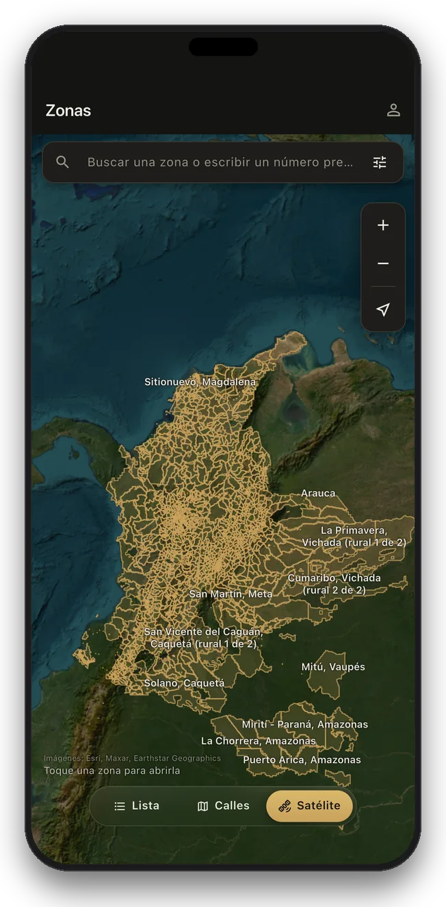
The whole country, on real maps
Over 11 million lots in 1,108 municipalities across all 33 departments. Switch between street and satellite, see every municipality in place, tap one and it opens.
Pictured: every covered municipality, from the Caribbean to the Amazon
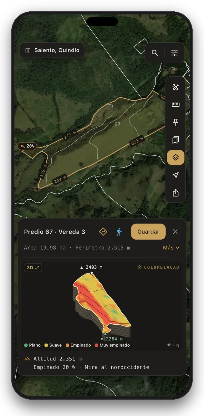
See the land in 3D
Tap any lot for its altitude, slope and facing, with a 3D model of the land you can turn and tilt.
Pictured: the Cocora Valley, Salento
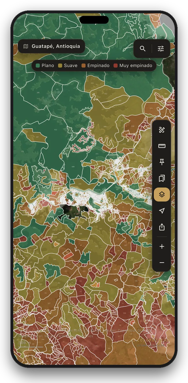
Every lot shaded by its slope
Turn on Terrain and every lot in the zone is coloured flat, gentle, steep or very steep. Or draw contour lines over the map, satellite included.
Pictured: Guatapé and its reservoir, Antioquia
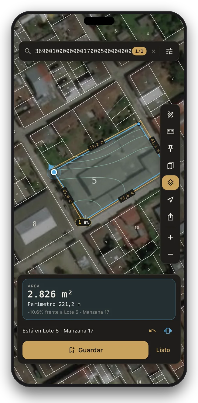
Walk your land and measure it
Tap the location button to see which lot you are standing in. Walk its edges with your phone in hand: the app guides you to each corner, buzzes as you near a border, and measures the area and side lengths of the path you walked. Accuracy follows your phone's GPS, usually a few metres.
Pictured: a lot in Salento, Quindío
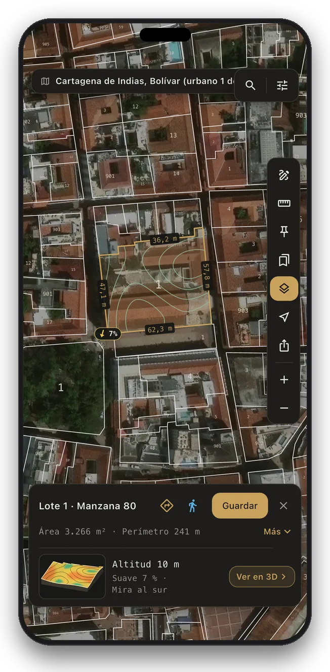
The cadastre over the real city
Every lot drawn over rooftops and streets. Tap one and it lights up with its area, its perimeter and the length of every side.
Pictured: Cartagena's walled city
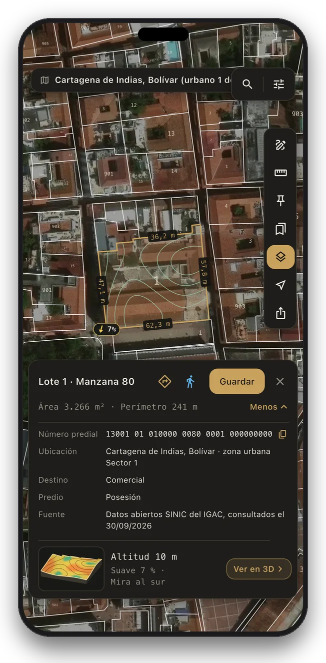
What the cadastre says, in one tap
More opens the número predial and the old number, the block or vereda, the economic use, the buildings and the source with its date. One tap copies the number.
Pictured: Cartagena's walled city
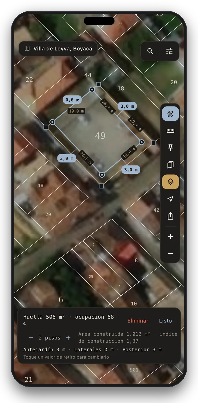
Plan a building on any lot
Sketch a footprint and the setbacks measure themselves: front garden, sides and rear, as Colombian land-use plans name them. Tap a value to change it and see the floor area and the occupancy and construction indexes at once.
Pictured: Villa de Leyva, Boyacá
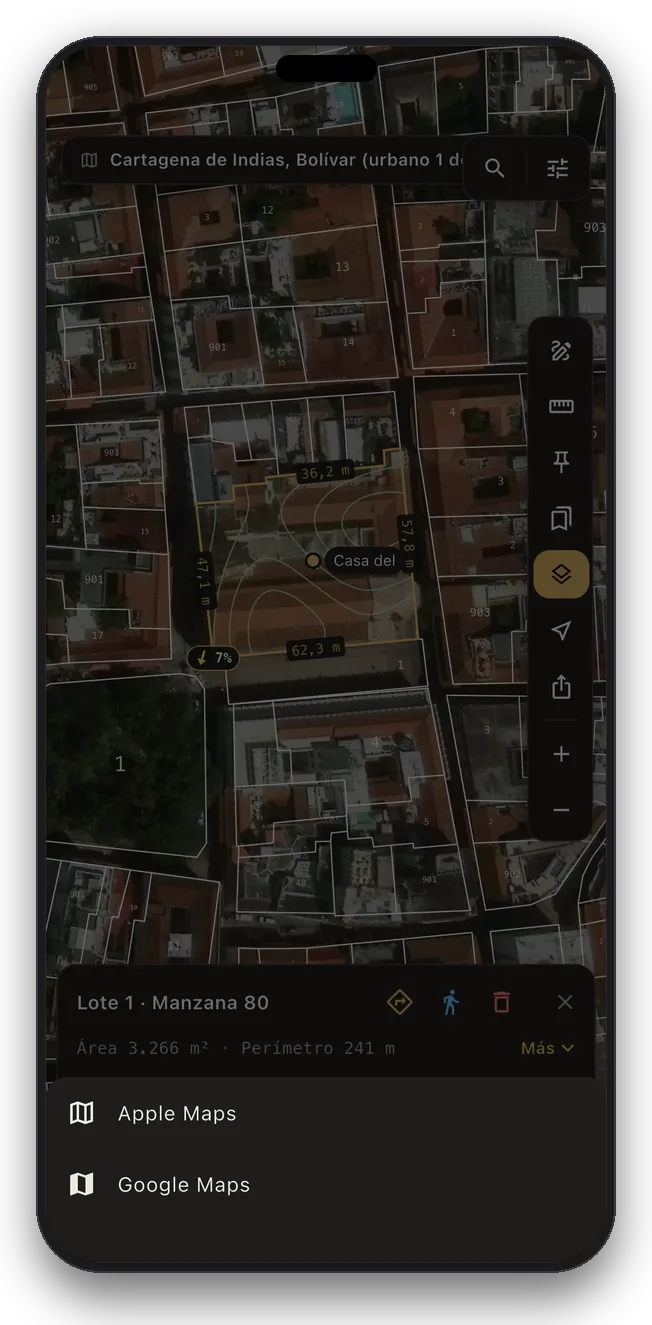
Get directions to any lot
One tap hands the lot to your maps app and guides you to the land itself, whether it is a saved lot, a measurement or a plan.
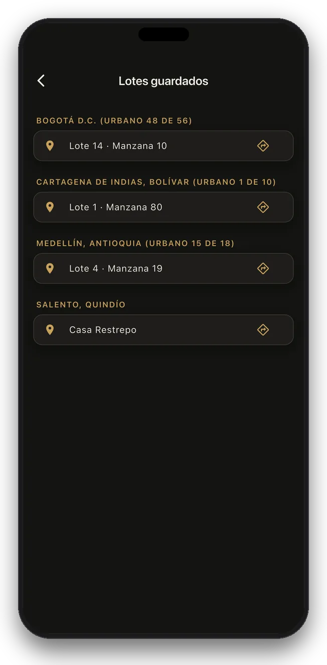
Every lot you track, one list
All your saved lots across every municipality, grouped by town, each one a tap away from the map or from directions.
Built for land work in Colombia
Any lot in seconds
The 30-digit número predial, the old 20-digit number, or the block and lot.
Area and perimeter
Tap a lot and read its exact area, its perimeter and every side length.
Inside the lot
Economic use, buildings, condition and source, as IGAC publishes them.
The land in 3D
Altitude, slope and facing for any lot, with a model you can turn.
Slopes and contours
Shade every lot by its slope or draw contour lines across the zone.
Where you stand, and how big
See which lot you are standing in and walk its borders with GPS guidance.
A ruler that snaps
Trace a shape for its area, slope and 3D, or draw a line for its elevation profile.
Plan a building
Front, side and rear setbacks measured for you, with the floor area at once.
Filter the lots
By economic use, urban or rural, and buildings: the matches light up.
By name or by region
1,108 municipalities, filtered by region and department, nearest first.
Street and satellite
The lots drape over real rooftops, streets and farms in any zone.
All the way to the land
One tap hands the lot to your maps app and takes you there.
Your lots, on all your devices
Name a lot and it syncs across your devices when you sign in.
The whole zone, no signal
Download once and use it on site, on the farm or in the mountains.
JPEG and print-ready PDF
Full A4 or A3 sheets, with the zone name and scale bar.
IGAC open data
Every lot names its source and the date of the cut. No owner names.
Spanish and English
The app follows your phone's language, or pick one in Settings.
Soon on your computer
At app.colombiacad.com, with the same account and subscription.
All of Colombia, one subscription
Monthly or yearly, it opens every zone we cover, current and future, plus JPEG and PDF export and your lots synced across your devices. Salento and Funza are open for you to try the app for free.
Maps are for reference and planning. They are not a certificado catastral or a survey. For transactions and legal matters, rely on the cadastre, the land registry office and a licensed surveyor.
Frequently asked
What is ColombiaCad?
ColombiaCad is an iPhone and Android app that shows Colombia's cadastral parcels: each municipality drawn lot by lot with its numbers, over satellite imagery or a street map. You can find a lot by its property number, read its area and every side length, see it in 3D with its altitude and slope, measure land on the map or on foot, and keep whole zones offline.
How do I find a lot by its number?
Type the 30-digit número predial in the municipality list and the app tells you which zone holds it. Inside a zone, tap the magnifier and type the número predial, the old 20-digit number, or the block and lot (for example 107-25). The map flies to the lot and shows its area, its perimeter and every side length, and one tap gives you directions to it.
Which municipalities does ColombiaCad cover?
1,108 municipalities in all 33 departments, with over 11 million lots, from La Guajira to the Amazon. Big cities come in several parts: Bogotá in 58 and Medellín in 28. A few municipalities are not in yet, such as Pereira, and the map in the app shows every zone available today.
Can I see the altitude and slope of a lot?
Yes. Tap any lot for its altitude, slope and facing, with a 3D model of the land you can turn and tilt. Terrain view shades every lot by how steep it is, or draws contour lines across the zone.
Can I measure my land by walking it?
Yes. Tap the location button to see which lot you are standing in, then walk its edges and mark each corner. The app guides you along the borders and measures the area and side lengths of the path you walked. Accuracy follows your phone's GPS, usually a few metres, so treat the result as a guide, not a survey.
Does ColombiaCad work without internet?
Yes. Download a zone once and it works with no signal, on site, on the farm or in the mountains.
Is ColombiaCad free?
The app is free to download, and Salento, in Quindío, and Funza, beside Bogotá, are open for you to try it. ColombiaCad Pro, monthly or yearly, opens every zone we cover, current and future, plus JPEG and PDF export.
Are ColombiaCad maps official?
No. They are for reference and planning. They are not a certificado catastral, a certificado de tradición y libertad or a survey. For transactions and legal matters, rely on the cadastre, the land registry office and a licensed surveyor.
Where does the data come from?
From the open data of Colombia's Instituto Geográfico Agustín Codazzi (IGAC): its public cadastre and SINIC, plus Itagüí's municipal cadastre. Every lot names its source and the date of the cut. It is open data under Creative Commons licences and includes no owner names or ID numbers. Heights come from the Copernicus GLO-30 model. Details are in the Terms of Use.
Can I use ColombiaCad on a computer?
Soon. The web version is coming to app.colombiacad.com, with the same account and subscription as your phone.